Home · How they form
The weather
How blizzards form
The Flagstaff office says blizzard conditions often develop on the northwest side of an intense storm system, where a tight pressure gradient results in very strong winds. [NWS FLAGSTAFF] It says the upper Midwest and Great Plains of the United States tend to be the region that experiences blizzards most often, with few trees or other obstructions to reduce wind and blowing snow. [NWS FLAGSTAFF] The National Weather Service office in Flagstaff notes that while heavy snowfalls and severe cold often accompany blizzards, they are not required. [NWS FLAGSTAFF] Sometimes, that office says, strong winds pick up snow that has already fallen, creating a ground blizzard. [NWS FLAGSTAFF]
Where the word came from
In the 1870s, the same page records, an Iowa newspaper used the word “blizzard” to describe a snowstorm; previously the term had referred to a cannon shot or a volley of musket fire, and by the 1880s the weather sense was used by many across the United States and in England. [NWS FLAGSTAFF]
Nor’easters
A nor’easter, the National Weather Service says, is a storm along the East Coast of North America, so called because the winds over the coastal area are typically from the northeast. [NWS NOR'EASTER] These storms may occur at any time of year but are most frequent and most violent between September and April. [NWS NOR'EASTER] The Service says the difference in temperature between the warm air over the water and cold Arctic air over the land is the fuel that feeds nor’easters, with the warm waters of the Gulf Stream helping to keep coastal waters relatively mild in winter. [NWS NOR'EASTER] Well-known nor’easters listed by the Service include the Blizzard of 1888, the “Ash Wednesday” storm of March 1962, the New England Blizzard of February 1978, the March 1993 “Superstorm”, and the Boston snowstorms of January and February 2015. [NWS NOR'EASTER]
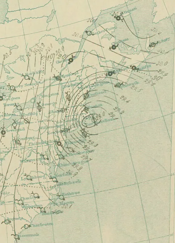
The 10 p.m. map of 12 March 1888 is a historical weather chart, not a photograph of the storm on the ground. It belongs with the formation story because it shows the surface pattern of a famous East Coast blizzard that the National Weather Service also lists as a well-known nor’easter.